Route:
Štrbské Pleso (Štrba tarn)(1350 m.a.s.l.) – Popradské pleso (Poprad tarn)(1500 m.a.s.l.) – junction above Žabí potok – sedlo Váha (Váha saddle) (2340 m.a.s.l.) – Rysy (2499 m.a.s.l.)
Return way: the same route
Elevation gain: 1 150 m
Duration: all-day – 8:20 h ( ↑ 4:40 ↓ 3:40)
Fitness level of difficulty: 3/3
Technical level of difficulty: 2/3
Starting point:
• Štrbské Pleso
• TEŽ stop Popradské Pleso
• Lysá Poľana
Chalets along the trail:
• Chata pri Popradskom plese (Chalet at the Poprad tarn)
• Chata pod Rysmi (Chalet below Rysy)
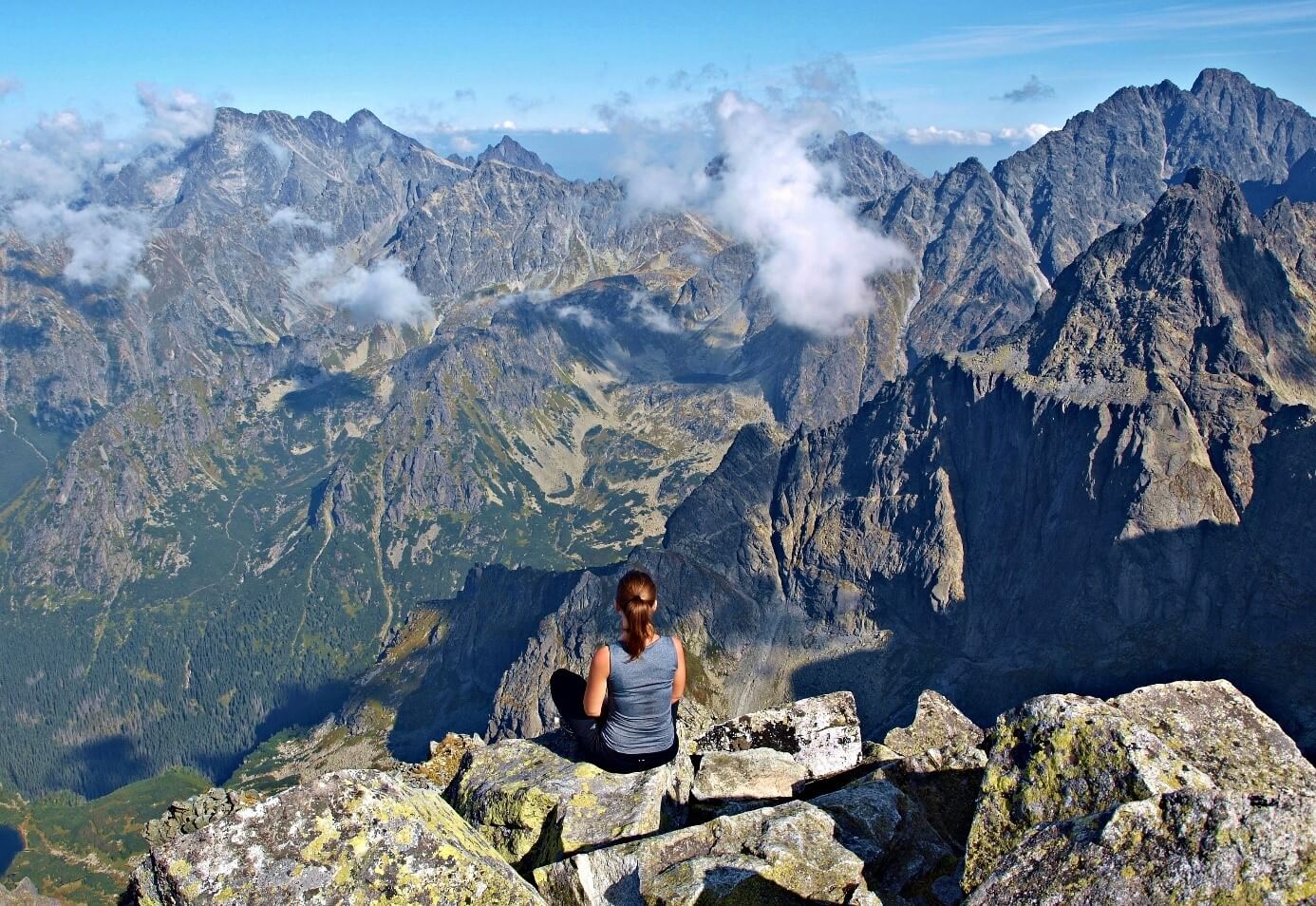
The ascent to Rysy belongs to one of the most popular hikes, mainly due to a magnificent view from the summit. Being situated on the Slovak-Polish border, Rysy have three peaks. The highest is the middle peak (2,503 m.a.s.l.) located in Slovakia, the second is the northwestern peak in Poland and the lowest one is the southeastern peak (2,473 m.a.s.l.). Every year, the Rysy Club organizes a 3-day event called the Rysy International Youth Meeting. Besides having a fun, the meeting’s main goal is to climb Rysy.
Starting off from Štrbské Pleso along the Tatranská magistrála (Tatra Highway) via Trigant, or taking a paved road from TEŽ stop – Popradské pleso, we reach junction near Chata pri Popradskom plese in about an hour.
From there, it will take 30 min’s walk in the forest, later in the dwarf-pine zone until getting to the junction above Žabí potok. Here, the red-marked trail takes us northward to Vyšné Kôprovské sedlo (2,180 m.a.s.l.). The ascent continues to the basin – Kotlina Žabích plies , with an easy part of the route along the tarns – Žabie plesá. Then follows a steeper ascent with fixed chains and after 1 hour 45 minutes we arrive at Chata pod Rysmi. We continue with an hour’s ascent across the Váha saddle (2,339 m.a.s.l.), dividing the Mengusovská valley from the Česká (renamed to Ťažká) valley, up to the summit of Rysy.
You go back the same way or it is possible to descend to the Polish side of the High Tatras, down to Morské oko (The sea eye)(as described in the Lysá Poľana variant), however it it is more time-consuming.
View from the top:
The summit/s offer beautiful views of the whole Tatras. Whilst the scenery in the east is dominated by the highest tatranian peak – Gerlachovský štít (2,654 m.a.s.l.), the ridge of the Western Tatras dominates in the west. On the Polish side at an altitude of 1,583 m.a.s.l. you can feast your eyes on the “Morské oko” – the largest lake of the mountain range.
Variant Lysá Poľana:
Elevation gain: 1,529 m
Duration of the ascent: 5 hours
From a border crossing in Lysá Poľana, a tourist trail leads across the mouth of the Roztoky valley to a chalet by the tarn – Morské oko. From Morské oko, the path continues right up to the summit of Rysy.
You may go back the same way or it is possible to descend to the Slovak side following the path to Poprad tarn or to Štrbské Pleso.
")
 2363 m.a.s.l.")
 (2250 m.a.s.l.)")